
Walking a Worcester County Street
A street search should start with the exact municipality. Worcester city offers the clearest address tools in the county, but a property in another town belongs in that town’s assessor system. Copy the street number and spelling exactly. In Worcester, use the property application to find the MBL, then check the GIS viewer for the parcel and the nearby identifiers. The Registry is the next source when the task is a land transfer or legal party, not merely an assessment entry.
Build the trail one record at a time. A voter match may verify a particular individual when its required fields are already known, but it is not a street roster. A historical directory or criss-cross volume can place a published household at an address in a specific year. Keep the source dates separate. The result is stronger when each statement is tied to the system that actually made it.
- Search the address in the correct municipal property record and copy the MBL or parcel identifier.
- Open the GIS map and note the target parcel, visible street name, and nearby parcel identifiers.
- Search the proper Registry district for the address, owner, document number, or book and page.
- Follow the recorded grantor and grantee trail only as far as the documents support it.
- Use an individual voter match or an old directory volume as a dated cross-check, not as a block list.
Worcester County Street Directory Fields
Inside Worcester city, the Property Records application accepts MBL number, street name, and owner name. Its result can lead to a property card, assessed values, land use, Worcester Atlas, permit history, map links, tax history, and municipal-lien information. The MBL is the most useful bridge because it identifies the parcel even when an address search returns several similar street names. The city’s published example uses an MBL format such as 12-345-67890.
The city says the assessed-owner data and valuation date belong to a particular update cycle. That makes the page valuable for a current assessment question, not proof of a person’s present residence or legal title. Worcester also warns that a deed mailing address can differ from the property’s situs address, and ownership updates can take four to six weeks after recording. The situs address is the physical property location; a mailing address is where tax correspondence is sent. The municipal route changes outside Worcester city.
| Property search field | What it locates | Useful follow-up |
|---|---|---|
| MBL | One assessed parcel | Map, card, permit, lien, and tax links |
| Street name | Address-keyed property results | House number and city confirmation |
| Owner name | Assessed-owner entry | Deed for legal-title question |
| Map or Atlas link | Parcel context and public layers | Adjacent parcel identifiers |
Worcester Property Records displays those search routes before a street-by-street record check begins.
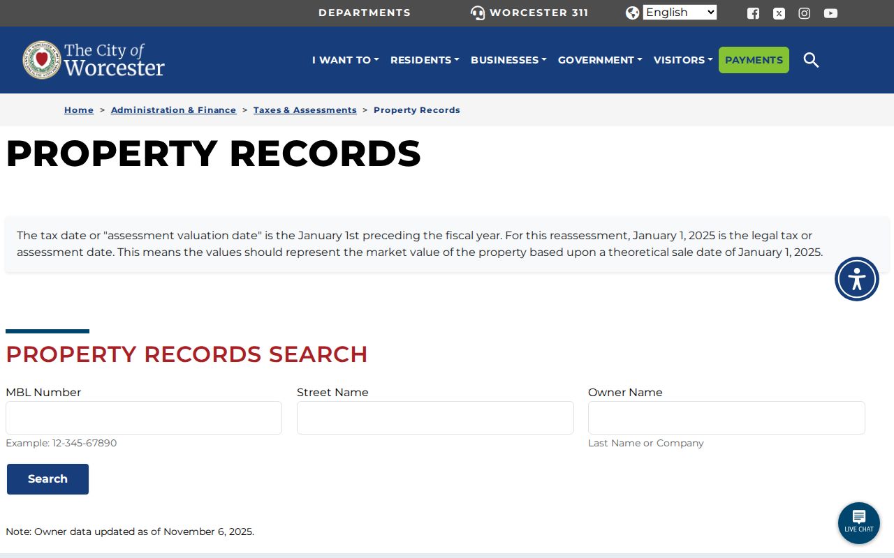
The property interface separates MBL, street-name, and owner searches, so a Worcester County street directory note should preserve which key produced the result.
Worcester Parcels Along a Street
The Worcester GIS Public Viewer and Worcester Atlas put a selected address in map context. The city’s GIS resources point to the public viewer, property application, downloadable datasets, and a digital data-request route. A researcher can select a target parcel, note the parcel identifiers immediately beside or across from it, and check those property results one at a time. That is a useful way to understand a block without treating a map view as a legal boundary product.
The city expressly warns that its maps can contain errors or be out of date and are not legal title or boundary evidence. The reviewed official sources did not verify a one-click buffer or radius tool in the public viewer. For a defined legal radius, use the city’s certified abutter request rather than describing an informal map browse as a complete neighbor search. A map line, an assessed owner, and a current resident are different facts.
- Parcel
- A mapped piece of land represented in an assessment or GIS system.
- MBL
- Worcester’s map-block-lot style parcel identifier used to connect city records.
- Situs address
- The property’s physical location, which can differ from a tax mailing address.
- Plat or plan
- A recorded map that can describe land, lots, and boundaries more formally than a viewer screen.
Worcester County Records by Street
Address-keyed sources do not all show the same relationship to a Worcester County street. The assessor card shows an assessment snapshot. The map viewer shows parcel context. The Registry records transactions and parties. Permit and lien tools show municipal events. The voter lookup is a precise individual match, while historical directories show a printed household or business at a date. Use the columns below as a choice of record type, not a promise that every source lists every person along an address.
| Street-keyed record | Custodian | What it can show | Access route |
|---|---|---|---|
| Property Records | Worcester Assessing | MBL, assessed owner, land use, values | Online, office, or mail |
| GIS viewer | Worcester GIS | Parcel placement and public layers | Public map browse |
| Recorded deed | Worcester Registry district | Legal parties, date, book/page, instrument | Index and image search |
| Permit history | Inspectional Services | Address or MBL permit events | City permit search |
| Municipal lien search | Worcester Finance | Informational lien result | Online or certified route |
| Historical directory | WHM or WPL | Dated household, occupation, business clue | Digitized, shelf, or staff access |
The City of Worcester’s permit-history search accepts MBL, street, and issued-to last name or company, and it separates building, electrical, gas, mechanical, plumbing, and temporary permits. It is an address-event source. It does not establish who lived at an address during the work.
Worcester County Deeds by Address
The Worcester South Registry supplies the county’s richest recorded-land route for the towns in its district. Its instructions describe free search and image viewing at the time of inspection. Post-1960 entries can be searched by name, book and page, document number, street address and town, and recorded date. A street directory researcher should capture the exact search family used, document number, instrument type, recorded date, book and page, parties, property description, and any plan reference before moving backward.
Pre-1960 work has a different path. Start in the scanned Grantor and Grantee index books, note the book and page, then use Unindexed Property Search to reach the image. The Registry’s history starts in 1731, but that does not make every older record equally searchable by modern address. For Fitchburg, Ashburnham, Leominster, Lunenburg, and Westminster, switch to Worcester North rather than Worcester South.
When the purpose is a backward address trail, the Worcester County past residents page uses the deed chain with directory and census checks. A deed alone records a transfer, not every household that occupied the property.
Worcester Street Names Over Time
Street names can be the reason a sound search seems to fail. Worcester Public Library’s “Your Worcester Street” guide covers about 2,296 streets and supplies local history and continuity clues. It can help a researcher connect a present address to an older directory, map, or deed spelling. Search the current form and each documented older variant, then compare the year on the source before deciding that the address changed hands or disappeared.
Franklin Street is the clearest local test. WPL material says it was formerly South Street and then Park Street, with the change occurring between 1912 and 1914. The line of the street also varied at other times. That history is not a reason to merge unrelated addresses. It is a reason to compare variants against the map, directory year, and recorded description.
Note: A missing result after a name change may be an address-normalization problem rather than proof that no historical record exists.
Worcester MBL Permit and Lien Trails
Several Worcester municipal tools reuse an MBL or address. Real-estate tax history searches by MBL, street name, or owner name and reports the past three calendar years. Municipal lien search accepts MBL, address number and street selection, owner name, and a Starts or Contains choice. Its online output is informational. The city lists separate certified-lien fees and a stated ten-business-day time frame, so an online screen should not be treated as a certified municipal lien certificate. Keep the search date with the result, because a short online window cannot describe every earlier tax or lien event.
For a missing parcel card, map layer, permit series, or older material, use the City Public Records Portal with a narrow description. Name the MBL, department, record type, date range, and preferred electronic format. The city says its RAO must permit inspection or furnish a copy within ten business days and prefers electronic delivery when available. A records request should ask for existing material, not require staff to create a new address analysis.
Worcester Street Directory History
Historical street work belongs on a shelf as well as a map. The Worcester Historical Museum has the digitized city and address-directory collection, including the 1829 directory and selected later runs through 1945. Its entries can include a home or residence marker, occupation, address, spouse clue, business, street section, and post-office detail. WPL adds house directories, census sources, maps, newspapers, and local reference help.
A criss-cross directory reverses the normal order by organizing information around an address. It can be useful when a street is known but a name is not. It still remains a publication clue tied to a particular year. The full historical collection and abbreviations are treated on the Worcester County city directory page, rather than being recreated as a current street record.
Certified Worcester County Abutters
Worcester’s certified abutter form is the correct route when an official radius is required. The form asks for requester contact information, street address, city, state, ZIP, MBL number, purpose, and requested radius. Its choices include Planning and Zoning at 300 feet, License Commission immediate abutters and 500 feet, Conservation and Historical Commission at 100 feet, plus another stated distance. The requested purpose matters because the city’s form connects each distance to a different administrative need.
The city says a certified abutter list is generally $20 and typically takes ten business days. This is not interchangeable with a GIS browse. The map can identify adjacent parcel identifiers. The certified product provides the city’s defined administrative list for the request. Keep that distinction when using the street directory for civic or property research.
| Informal map review | Selected parcel and nearby MBLs, with map limitations. |
|---|---|
| Certified abutter list | Defined radius, purpose, fee, city processing route, and official request form. |
| Individual voter match | Required-field person verification, not a public street list. |
Worcester County Street Directory Limits
A Worcester County street directory cannot prove every occupant of a house. The assessor reports an assessed owner at an assessment date. A deed identifies parties to a recorded instrument. A directory prints a household or business in its publication year. A GIS viewer shows a parcel and layers. Voter information is guarded by a required-field individual lookup and central-registry restrictions. Those sources can support a carefully dated address trail, but they cannot be combined into an unrestricted resident roster.
Use the appropriate custodian when the question needs a certified result. The Registry handles legal-title records, not the assessor. A city clerk handles local certificate rules. A court clerk controls restricted or complete case access. The Massachusetts Address Confidentiality Program, sealed and impounded matters, vital restrictions, and voter rules remain in force even when an address appears elsewhere in a public system.